Story
How space is helping to tackle societal issues
10 October 2023
This World Space Week we want to celebrate the ways in which space technologies are helping PML to address societal challenges across the globe:
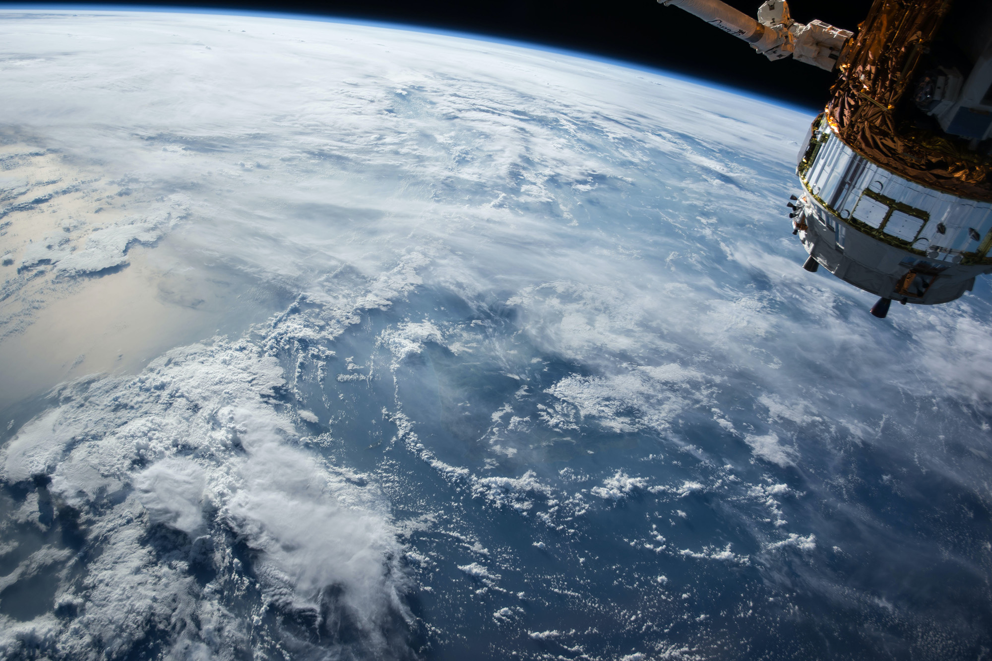
NASA | Unsplash
 Illegal fishing
Over-exploitation of marine resources, inefficient management and insufficient support of sustainable development may result in the depletion of fish stock and degradation of marine ecosystems, causing direct threats to food security and livelihood of local coastal communities.
By using state-of-the-art satellite technologies and developing new methodologies, PML scientists are helping to detect illegal fishing activities, such as unregulated vessels and aquaculture infrastructure. The team developed the first map of aquaculture structures in Palawan (Philippines) consisting of 1500 objects, which allowed authorities to assess the sustainability and trends of the proliferation of fish cages.
These techniques have now been developed as commercial services within the EC Horizon project NextOcean to address the requirements of the fisheries and aquaculture industries in multiple countries.
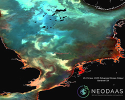 Harmful Algal Blooms
Harmful algal blooms (HABs) can have significant economic, environmental and societal cost and are expected to increase in frequency due to climate change.
PML scientists use satellites to pioneer new approaches for detecting HABs and tracking their transport and dispersion as well as developing cost-effective, rapid and user-friendly alert systems for the aquaculture industry and other sectors interested in water quality issues.
The team have been instrumental in the development of the S3 EUROHAB alert portal; a web based alert system for tracking the growth and spread of HABs in the English Channel.
 Oil spills
Oil spills can have devastating impacts upon the marine environment and it is estimated that over one million metric tons are released annually into the world’s oceans. On-the-ground spill detection can be difficult and expensive, often resulting in spills being left untreated for extended periods. Repeated small spills can further lead to accumulation within the environment, as the harmful chemicals found in oil can persist for a long time.
Scientists at PML have used satellite imagery from Copernicus Sentinel-1 in combination with machine learning to identify oil slicks in a highly-automated and cost efficient manner.
All detected slicks are reported to relevant stakeholders, allowing quick responses in the form of containment and clean-up, as well as helping to identify spill occurrence patterns over time.
 Cholera
Cholera is a waterborne infectious disease that can cause severe diarrhoea and even death. It continues to be a major public health threat in 175 countries across the world, with up to 4 million people contracting the disease and 21,000-143,000 deaths occurring each year.
PML’s research in this area aims to reduce the spread and overall burden of climate-sensitive infectious diseases, such as cholera, by taking advantage of satellite technology to develop maps of flooding, water quality and environmental Vibrio cholerae risk.
These maps will be used to provide to stakeholders and end-users through an associated sanitation and disease app. The intention is that this work will be readily transferrable to other regions and bacterial threats that are emerging under climate change.
 Marine litter
The marine litter issue is a growing concern. Discarded items from human activities can be found across the globe, even in the most remote seas and deepest parts of the ocean. Ocean fronts, regions that are hot spots for marine life, have been observed to be accumulation zones for floating marine litter.
PML’s scientists are at the forefront of research in using satellites to detect fronts and are currently developing a prototype for identifying areas at risk of accumulating marine litter. On our coasts, PML is using hyperspectral sensors on drones to characterise plastic debris, in order to develop better methods for shoreline plastic detection and enabling monitoring.
For microplastics we cannot see directly from space, PML has been investigating using indirect detection measures, such as suspended particulate matter (SPM) for which initial studies in the Tamar River (UK) have shown a significant correlation between SPM and microplastic concentration.
 Marine ecosystem functioning and health
The marine environment provides society with countless benefits, from food and other resources to climate regulation and nutrient cycling, to name just a few. Due to the size of the ocean, it is a great challenge to monitor all of its functions and overall health.
For many decades PML has been a leader in ocean observation methods, through the application of satellite techniques, driving innovations and developing more efficient ways of satellite monitoring, to help increase understanding of ocean functions and health.
The team are developing effective satellite tools to help monitor ocean carbon, marine biodiversity and how community structure and the functions of marine ecosystems may respond to climate change. The team is also part of a significant collaborative effort to improve the ways in which satellite-derived data is used to better understand some of the challenges associated with climate change and ensure well-informed decisions around climate resilience.
Some of this research will be showcased at the UN Climate Change meeting COP28 later this year, such as work concerning the ocean’s biological carbon pump, climate change and human health, and primary production in the Atlantic, which is important for food security.
PML's commercial arm, PML Applications Ltd, also provides satellite data products and services through the Centre for Geospatial Applications, delivering vital information for companies in a variety of sectors on:
- Land classification mapping
- Data visualisation & analysis
- Commercial drone operations & surveys
- Earth observation training & capacity development
- Water quality monitoring
- Oil spill detection
- Harmful Algal Bloom monitoring
Related information
NextOcean projectS3 EUROHAB project
Satellites detecting oil slicks
Climate-sensitive, water-associated infectious disease
FRONTAL project
UK Earth Observation Climate Information Service (EOCIS)
BiCOME project
BOOMS project
HyperBOOOST project
BICEP project
Paper: In situ correlation between microplastic and suspended particulate matter concentrations in river-estuary systems support proxies for satellite-derived estimates of microplastic flux