Story
21 years of satellite data finds PP to be a better indicator of marine disturbances than Chl a
28 September 2022

Phytoplankton are responsible for about half of global primary production (PP) and in the North Atlantic, and represent a significant sink for CO2.
What is marine primary production?
Marine primary production is how much carbon dioxide is fixed through photosynthesis by marine algae.
Primary Production is driven by light, nutrients (both macro- and micro-nutrients, such as iron) and temperature. Any perturbations in these parameters, be it from natural disturbances such as volcanic activity, dust deposition, wildfires, or anthropogenic (pollution originating from human activity) disturbances such as climate change and eutrophication can be reflected in the magnitude and timing of daily PP, which ultimately affects the annual rates of PP.
Primary production is highly sensitive to changes in the ecosystem and can be used as an early warning indicator for disturbance in the marine environment.
Understanding the variation in chlorophyll a (Chl a) and PP under the influence of the natural range of water column mixing, light and nutrient regimes is necessary to distinguish the natural seasonal cycle from environmental perturbations caused by anthropogenic and natural disturbances that are outside of this area.
Historic indicators of good environmental status of the north-east (NE) Atlantic and north-west (NW) European Seas suggested that daily PP should not exceed 2–3 g C m−2 d−1 during phytoplankton blooms and that annual rates should be <300 g C m−2 yr−1.
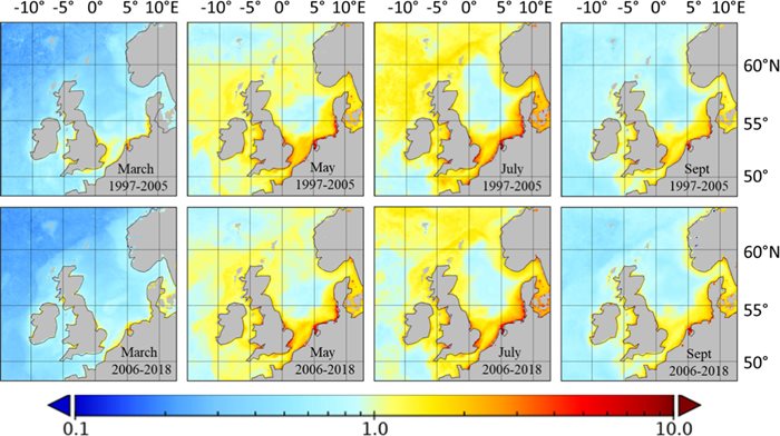
In a new study led by Plymouth Marine Laboratory, and supported by at the Institute for Chemistry and Biology of the Marine Environment and the Royal Belgian Institute of Natural Sciences, scientists have used 21 years of Copernicus Marine Service (CMEMS) Ocean Colour data from September 1997 to December 2018 to assess areas in the NE Atlantic with similar peak, climatology, phenology and annual PP values.
Two case studies were used to test the validity and accuracy of these thresholds.
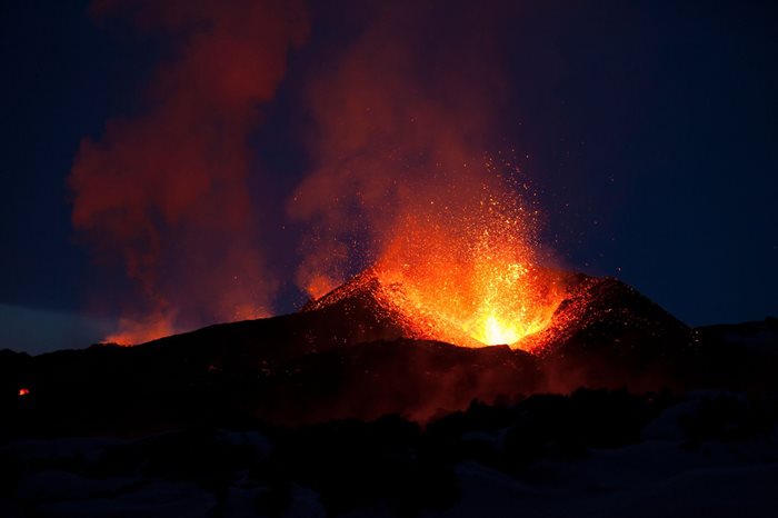
The first was the eruption of the volcano Eyjafjallajökull, which deposited large volumes of volcanic dust (and therefore iron) into the NE Atlantic during April and May 2010. A clear signature in both PP and chlorophyll-a (Chl a) was evident from 28th April to 6th May and from 18th to 27th May 2010, when PP exceeded the PP P90 threshold for the region, which was comparatively more sensitive than Chl a P90 as an indicator of this disturbance.

Pictured: 2010 eruption of the volcano Eyjafjallajökull, in Iceland.
The second case study was for the riverine input of total nitrogen and phosphorus, along the Wadden Sea coast in the North Sea. During years when total nitrogen and phosphorus were above the climatology maximum, there was a lag signature in both PP and Chl a when PP exceeded the PP P90 threshold defined for the study area which was slightly more sensitive than Chl a P90.

Dr Gavin Tilstone, Bio-optical oceanographer at PML, who led the study, said:
“Chlorophyll-a has previously been used as an indicator of water quality, but actually, primary production thresholds provide a more sensitive means of determining disturbances in the environment, both in the coastal and offshore waters in the NE Atlantic, using remotely sensed ocean colour data.”
“This is an important development, we will now be better equipped to monitor and detect anthropogenic effects in the marine environment – now more vital than ever in the global fight against climate change.”
Access the full publication here >>